
23/03/2020 UPDATE regarding social distancing activities associated with COVID-19 pandemic
Please note, the Easter party planned for Saturday April 11th 2020 has been CANCELLED. In addition, Whitlands Community Planning Group meetings will be suspended until further notice
The Whitlands Community has built this website to create a resource for the region.
The Whitlands High Plateau is a 12km long high-altitude ridge that runs above the Western side of the King Valley in North-East Victoria. It’s sort of a peculiar place, not quite alpine, not completely agricultural, with very dense forest that breaks occasionally to reveal magnificent views across the snow-covered mountains. No pub, no post office or shop, but with a population of 33, there is a thread of determination that runs through the families here. There are easier places to live, but the remoteness seems to bring out an industrious approach which can be seen throughout the region.
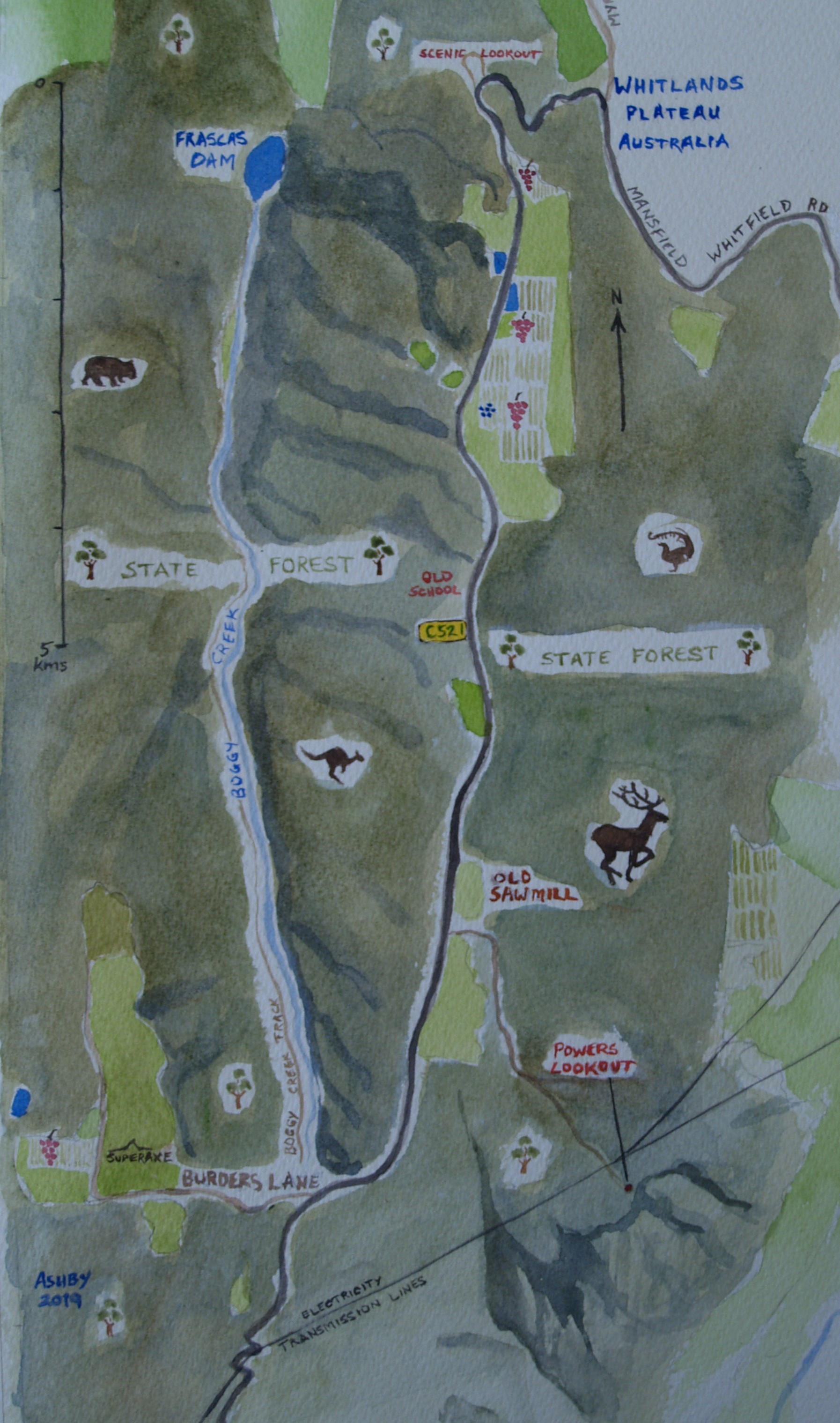
Watercolour map of Whitlands by resident artist Michael Ashby…
HIGHLIGHTS
WHITLANDS THE PLACE
Whitlands is in North-East Victoria, about 2.5 hours drive from Melbourne. Situated on a plateau 700-900m above sea level, Whitlands is sub-alpine and boasts expansive views towards Benalla and Wangaratta, and across the Alpine National Park as far as Mt Buffalo, Mt Feathertop, Mt Cobbler and beyond.
community projects
Despite being a small community, Whitlanders have always been an active bunch, having achieved many community projects over the years. Annually, projects are chosen by The Whitlands Progress Association (WPA) Inc. and fed into the Whitlands Community Planning Group, to complete.
local businesses
A resourceful bunch of people, Whitlanders have made the most of what the area has to offer establishing thriving businesses in a place that could be considered remote. Business activities range from agriculture, viticulture and horticulture to engineering and manufacturing, wine making and creating beautiful art.
ACMI COLLECTION VIDEO
Powers Lookout
Powers lookout offers splendid views of the King Valley 300m below, and across the Alpine National Park. The lookout is a few kilometres off the Mansfield-Whitfield road along a well graded dirt road. The outermost crag and northern viewing platform can be accessed via a walking track and a series of steep ladders.
Powers lookout is so named as it was a hideout and vantage point for infamous bushranger Harry Power, who was captured here by police on the 5th June 1870.
